The below dive site maps aim to guide scuba divers to visualize the layout of the most famous dive sites around Pulau Sipadan, Mabul and Kapalai, Mataking, Pom Pom Island and the surrounding reefs.
Contact Us for more information about the scuba diving in the Sipadan area.
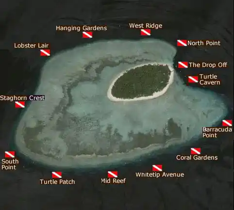
Pulau Sipadan dive site map
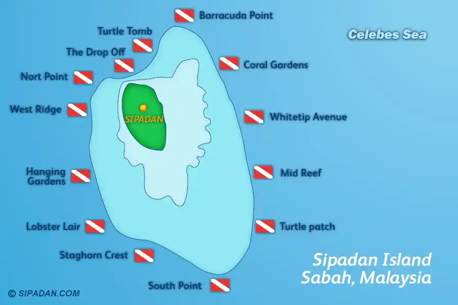
At Pulau Sipadan, the dive site map shows the signature sites are as Barracuda Point, the Drop Off, South Point and Turtle Tomb. Expect steep walls going as deep at 600m to the bottom floor. Current can be strong depending on the tide and drift dives allow for observations of pelagic sightings. Note that Turtle Cavern/Turtle Tomb is restricted for properly certified and equipped cave divers and only a couple of dive resorts bring divers there. Recreational divers will remain outside of the entrance of Turtle Cavern.
Mabul island dive site map
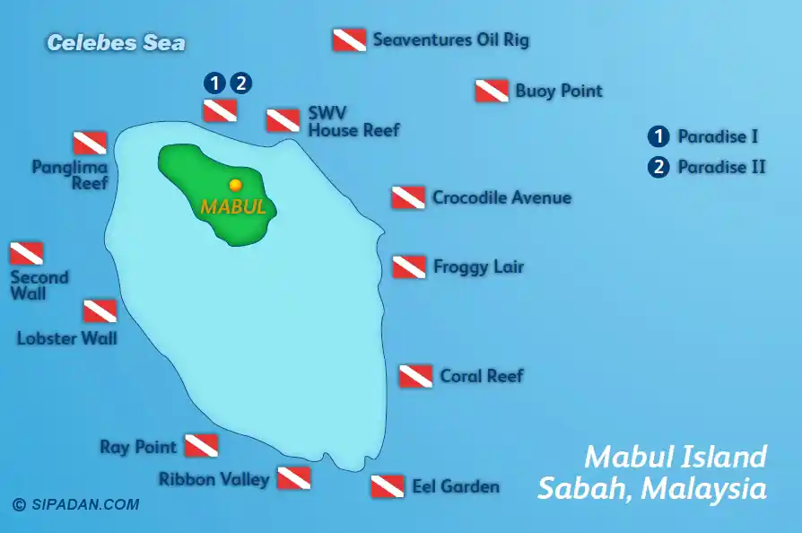
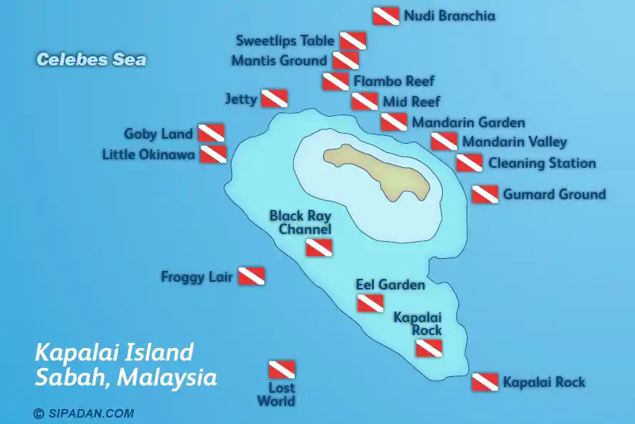
The Mabul's dive site map emphasize muck diving friendly zones, patch reefs, house reefs, artificial reefs and manmade structures along with rubbles where juvenile and adult frogfish, flamboyant cuttlefish, and seahorses are to be found. Depths typically range from 5-20 m, making it ideal for third dives and are also suitable for snorkelers seeking calm conditions above the corolorful coral gardens. Kapalai (which is built on a sandbank), features scattered coral bommies and shallows along with light currents.
Pulau Kapalai dive site map
Pulau Mataking dive site map
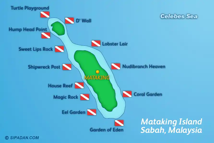
Islands around Mataking dive map
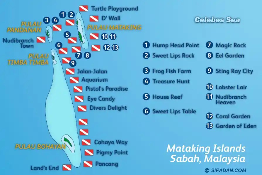
UW visibility and currents change with the tide, the season, the waves and the weather. Treat the maps as a tool and follow the detailed boat briefing from your divemaster guides before every dive. Conservation zones and no-touch reminders are here to protect corals, sea turtles and the resident black-tip reef sharks.
Tun Sakaran Marine Park and Semporna Islands dive map
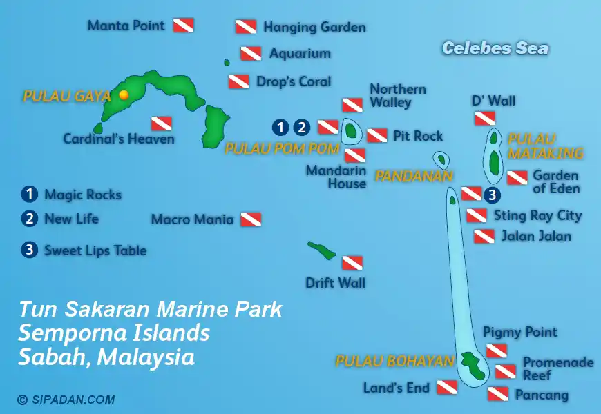
For the latest dive site access, Sipadan diving or snorkeling permits and seasonal recommendations (Sipadan is closed in November), confirm with us details during the booking process so that your daily plans align with the expected conditions and park guidelines.
Malaysia dive site map
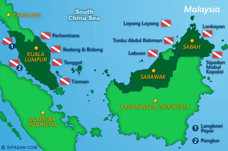
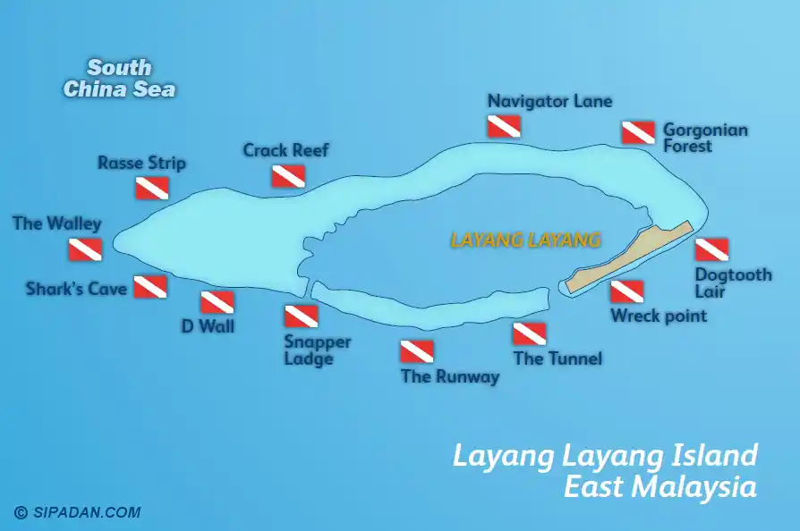
Layang Layang dive site map
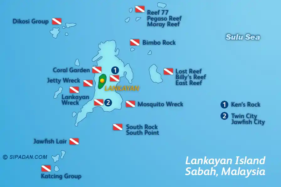
Lankayan dive site map
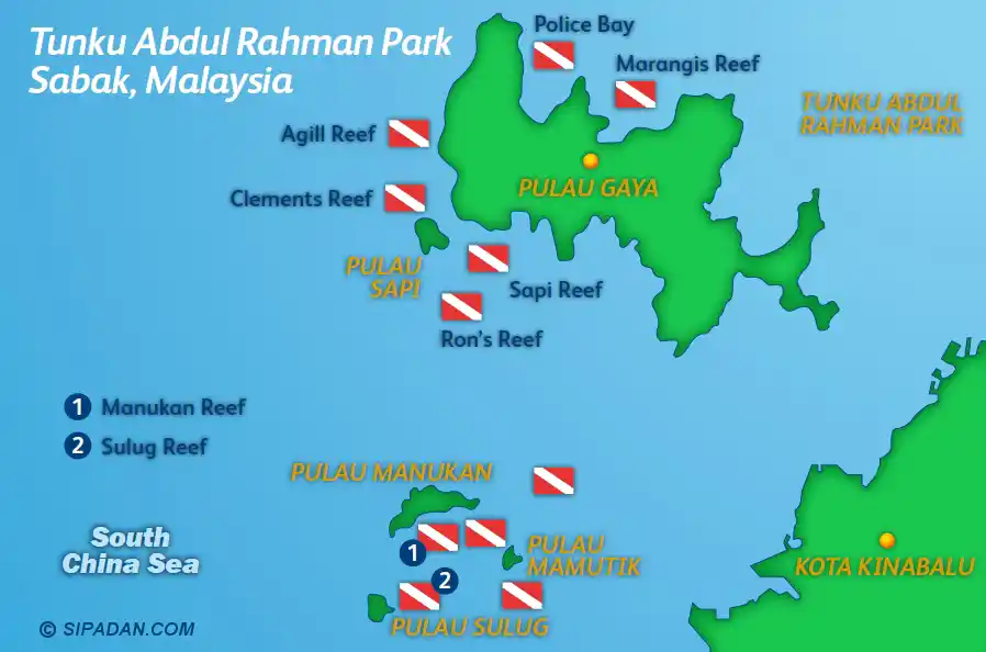
Kota Kinabalu and Tunku Abdul Rahman Park dive map
Contact Us for more information about the scuba diving in the Sipadan area.